
The Awaji Map in Warlord: Awaji
A heightmap island with real shrines, six samurai clans, monk factions, and no disembodied campaign camera.
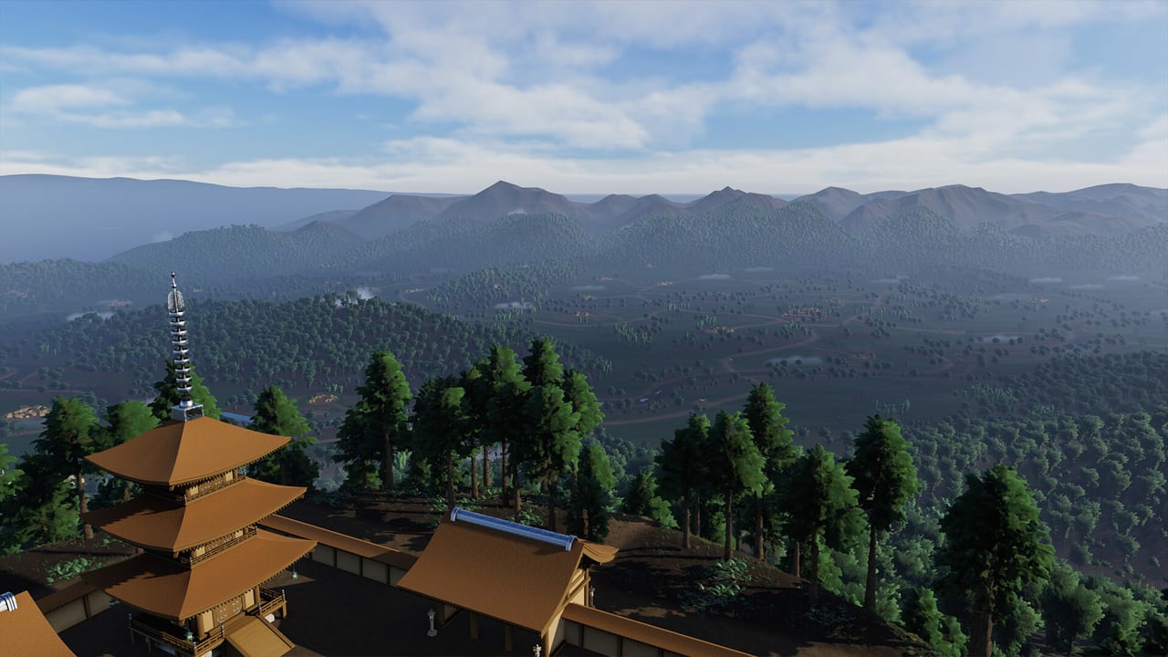
Warlord: Awaji does not give you a painted Total War map. Darkmatter’s own line is boots on the ground: no overworld, no disembodied camera, you and the retinue on a heightmap of Awaji Island. The July 2026 development note described that map as 16 by 16 kilometers. Water eats a large share. Playable land is still estimated at three to four times Warlord: Britannia. If you are looking for a minimap that moves armies as counters, you bought the wrong genre. Read conquest for how a place actually changes hands.
The island is the real Awaji, rebuilt from height data and checked against Google Earth for famous shrines, temples, and where people actually live. Dozens of religious sites are placed from life. That is why a random torch run feels wrong: you are standing in a geography someone can look up.
What sits on the island
The same July note said more than a hundred settlements, about six samurai clans, and a similar number of monk factions. Clans take names from nearby real localities. Main roads tend toward samurai seats, temples, and shrines. Thin paths peel toward farms and homesteads. Follow a road when you want progress. Take the offshoot when you have food, a packable camp, and a formation that is not a blob.
Civilian convoys and roaming warrior bands share those roads in real time. Local clans react to what you do. Capture rival shrines to swing spiritual aura. Work with warrior monks for curses and coalition strikes when you have a line that can stand on temple stairs. None of that is a fog-of-war puzzle on a paper map. You see a roof, you walk to it, you fight or you leave.
The Nanbokucho setting is fourteenth century, hundreds of years before the usual Sengoku roster. Historian Thomas Conlan advised the project. The interview on this page is the long-form talk about that period and why Awaji is not another Oda fantasy. Use it for context. Use the walkthrough for a conservative first-week route that does not invent town names.
How to navigate without a strategy overlay
Radar is not a map of the island. It is friend-or-foe inside a range and inside your field of view. Compass bars in first-person screenshots (N, E, S, W) tell you heading. Roads tell you intent. Ridges hide you. Valleys funnel you. That is the whole navigation language.
A World Teaser from August 2026 showed camps and settlements from a high angle for marketing. In play you do not get that camera as a command layer. You get your eyes, a compass, and retainers who will walk into a tree line if you never assigned them. The army drag-and-drop menu is how they hold a road while you look at a shrine gate.
Do not expect Takeda or Oda banners. The developer has said the period is earlier. Armor colors and clan names are local. Highlights exist so Instant Action players are not lost; in campaign you are meant to learn your own people’s kit. Turn highlights off only after you can read them.
Scale, water, and why the first army hurts
Three to four times Britannia’s playable area means you can overmarch. Launch discussions already describe a first enemy column that outnumbers a fresh retinue. That is the map talking: you are not in a demo corridor. Save before you take a road you cannot see the end of. Steam reviews say there is no autosave. Troubleshooting repeats that because people lose an hour to one fight.
Water is not decoration. The 16 km square includes coastline. Do not plan a Roman-style straight march across a bay you cannot ford. Stay on roads until bow and cavalry gives you a reason to cut a field.
Resources on Awaji are not a Britannia wood-cutting sandbox. Launch players asked where materials live. Treat captured stores and camp food as the visible economy. Overbuilding the tutorial camp wastes the extra stock vR101 handed you. The island is large; your first yard should be small.
A map habit that survives the first week
- Finish the nearby homestead. Do not pick a second roof because it looks good from a ridge.
- Pitch a camp you can pack.
- Walk one main road toward a shrine or a named seat you can retreat from.
- Grant land to one leader who lived.
- Only then look at the next valley.
The guides hub is the rest of the library. This page exists so you stop searching for a campaign-map overlay that Darkmatter refused to build. The island is the map. You are on it.
Frequently Asked Questions
Quick answers for new warlords landing on Awaji.
How big is the Warlord: Awaji map?
The July 2026 dev note called it 16×16 km including water, with playable land about three to four times Warlord: Britannia. You walk it in first person.
Is there a strategy-layer map like Total War?
No. Darkmatter’s design is no overworld camera. Radar is friend-or-foe, not an army overlay. See controls.
How many settlements and clans?
More than a hundred settlements, about six samurai clans, and a similar number of monk factions, per the July 2026 note. Names follow real localities.
Are the shrines real places?
The studio used heightmap data and Google Earth to place temples and shrines from life. Treat them as captures in conquest, not as tourist pins.